Day 11: Roseville (Sacramento) CA

Distance traveled: 228.4 km

Cumulative distance: 2785.9 km

Maximum speed: 123 kph

Moving average: 66 kph

Temperature range: 15.6 - 32. 4

I'm all done and ready to go with a new mirror and tire. 

Before leaving the Airbnb, I had a "map tour" from the host, Rob. He has a treasured collection of old maps, beautifully mounted and framed, all depicting centuries-old Scotland, England, Italy and parts of North America. They weren't necessarily from the time they were mean to depict but they were old, decades or hundreds of years. Rob had offered the tour when i arrived but I was so tired at that time that I just didn't think I would be able to give it the attention it deserved and thankfully, he was respectful of that. However, he was determined and his last opportunity was this morning since I was heading out. I indicated that the departure time would be 9:30 am. I was thankful that he had a phone conference at 9:00 am. I will say it was a fascinating presentation.

It turned out to be a 10:00 am departure. I checked Google Maps just before departure to make sure there were no obstacles and in fact, there was an "incident", closing the interstate to Sacramento. Even though I don't like riding interstate highways, I figured I needed to make an exception today because Honda was going to "squeeze me in" to mount the tire and I needed to be there as quick as reasonable. Since the decision about riding the interstate was made for me, I was forced to come up with an alternate route at the last second. That route turned out to be Hwy 128 up the Alexander Valley, through the heart of Napa, the Sierra Mountains and then across the plains into Sacramento. It was bittersweet. The ride was spectacular and took me past many wineries that I knew: Berringer, Sterling, Freemark Abbey, all wineries that I like. The road was twisty and there was an endless stream of super cars, classic convertibles and stretch limos, even before 11:00 am. I would love to ride this road when I wasn't worrying about being somewhere.

I had called Roseville Honda Motorsports in Sacramento to source a tire when I decided to make the switch. They didn't have what I wanted in stock however, they told me that there were two at the Roseville YAMAHA dealer, so I had called them and spoke to Colby on the parts desk. Colby held the tire for me and  said if he wasn't too busy, he could probably get it over to Honda for me, about 5 km away. I had been visualizing tying it onto the bike, with it resting on the back of the seat with ropes securing it to the top case.  

When I finally got to Yamaha about 1:30: Colby was on lunch and my heart sank. Luckily, I was 

Colby

milling about waiting for someone to fetch the tire and Colby came back onto his shift. He got the tire and then offered to drive it over in his car to Honda for me and suggested I follow him so I could find my way. Motorcycle riders are a community, which is why I always wave. Thanks again, Colby. 

When we get to Honda, I ask Colby if he is going to come in with me and trash-talk the Honda guys. A few of them know him and say hi. But it was short lived and he was on his way back to work; it didn't have time to fool around because they were short staffed today.

I am so late in the day that the service department tells me they can't promise it will get done, since they are backed up. It's 2:30, they close at 5:30 and the service guys hadn't taken lunch yet. My only alternative would have been to carry the tire with me, which would have presented its own set of challenges, not the least of which would have been a place to install it. I elect to have them work on it and if they don't get done, well, I'll have a weekend holiday in Sacramento (since Honda is closed  Mondays).

While I am waiting, I find myself a nearby motel with the flexibility to take me for either one night or three nights but I would tell them which when I showed up.  To my amazement, the service guys roll my bike out at 4:00 pm. They lend me a socket wrench to install my mirror so that I don't have to dig everything out of my kit. While I am doing that, the service rep gives me some tips about a route to Yosemite.

When I get checked into the motel, I go for a walk... to the bar. It is a bit of a dive bar; inside they have a glassed-in smoking section; something I have never seen before. There are about 15 people inside  including about 9 sitting at the bar. The bartender, who looks a great deal like Jason Mamoa, is hardworking and knows virtually all the customers by name and is quite respectful to me, even though he looks dangerous. Like me. 

bar poster

I didn't know karaoke was still a thing!

Smoking or non-smoking?

Day 10: Wine Country

 Distance traveled: 57.7 km

Cumulative distance: 2,557.5 km

Maximum speed: 116 kph

Moving average: 60 kph

Temperature range: 28.6 - 29.0

I had a chill day here in Windsor. I slept like a log until 8:00 am, my first sleep-in on the trip and it was worthwhile, though I was a little groggy initially and I had lost some incentive to pretty much do anything; especially get on the bike. Sat outside visiting with the host and his high school friend visiting from Maine. They have been friends since junior high, in the early 60s. Then i organized myself a new a new rear tire. That's what happens on longer trips. My existing tire I think would have lasted but it would really have been tired (no pun intended) by the time i got home.  I once did a trip with a fellow who tried to squeeze every kilometre from his rear tire and ended up regretting it. I decided on not taking a chance.
Being in wine country, I thought I should do some wine tasting. After a couple of coffees and some breakfast, I started coming around and my desire to have a worthwhile day improved. 

The last time we were here (which was probably in the 90s) the Sonoma wineries were mostly small, family wineries whereas the Napa wineries were the big chateau-styled estates.  Plus, in those days, Sonoma wineries didn't charge for a tasting. Not that I expected that now. I haven't been touring all over and I am sure there are family wineries around but the vibe has changed somewhat.

I hadn't spent a whole lot of time thinking about what wineries to visit so, like everything on this trip, i was choosing on the fly. I decided I would go to the Francis Ford Coppola Winery so, if nothing else, I could look at the movie memorabilia. Close by was another winery called Trione. I did not know the winery but I had read some positive commentary on it so I thought I would give it a try.

The first I visited was Trione.  Big estate but not really "chateau" style, they have 600 acres 
and only produce wine from 3% of their grapes, the rest being sold to other wineries. The gal conducting the tasting was... my vintage, and we had a discussion about the evolving nature of the wine industry and how young people are not interested in wine like we were, that they are more interested in craft beers. I think I had read the same article about a month ago. I enjoyed the wine there quite a bit and i would characterize it thus: if we were on a driving holiday, I would happily carry home a case but riding, I would not organize shipping a case to the border and then collecting it there later.  The person conducting the tasting, even knowing that I was on a motorcycle,  was astounded that i wasn't taking any with me. 

After, I went to the FFC winery. THIS is a palatial estate, definitely more French chateau styled, with an American twist. There is a swimming pool and a cocktail bar in the courtyard . When I presented myself, I was told $25 for a half hour tasting, $40 for a one hour tasting. I thought "more money, more time, more wine". Since i didn't want to move in I opted for the shorter session. The stuff I tasted was cheap plonk that you can get at any winery anywhere. I was very underwhelmed and left disappointed I had wasted a wine tasting. Turns out, the $40 tasting was more money, same quantity, better wine, carried further. However, looking at the movie memorabilia was interesting.


An actual Tucker. No. 37 of 50 produced.


I stopped on the way back to do a couple of errands and filled the gas tank so that I would have full range for my ride to Sacramento. Not sure how long it will take because the various sources of estimates are varying, from 2 1/4 hours to 3 1/4 hours; I'll assume the longer and hope for the shorter.

Brahm Stocker's Dracula costumes.

Copola's wall of fame.

Apocalypse Now 

Day 9: Windsor, Sonoma California

 Distance: 207.9 km

Cumulative distance: 2499.8 km

Maximum speed: 125 kph

Moving average: 60 kph

Temperature range: 16.0 - 35.8

Maximum elevation: 649 metres

I had spent the night before plotting out a destination for Thursday night. I figure after a week straight of camping I was due for a proper bed with sheets, so had booked an Airbnb.

When I get up, Russell is waiting for me and when he sees me walking to the shower, he calls out and asks me if I would like a cup of coffee. The old, classic "bait and switch". I said sure, after my shower. The shower is coin operated and only take quarters. So I plunk in three quarters only to discover that it takes a minimum of four to get the water going so I have to go back out and ask Russell if he can lend me a quarter. He gives me a $1 token. He saved me from a long walk in my pajamas back to the gate.

Once I have showered, Russell is ready for me. He asks how I like my coffee and he delivers a cup with WHIPPING cream. AND cleaning product. Russell wants to detail my bike. Maybe he thinks I'm a slob and that he could do better, I don't know and even though I am slightly embarrassed, not too much and he gets to work, Have at her, buddy. While he is doing this, he tells me about all the cleaning of vehicles he does, for himself, his neighbours, his neighbours who are away, that he has a long pole for cleaning high on his super fancy camper van and that he made a bunch of modifications to his van as he is a retired machinist from Boeing. I ask him if he has seen the Netflix documentary about the Boeing 737 Max. He seems oblivious, maybe because he has been retired for seven years. Russell loves to visit and the coffee was the price. It's ok, I'm not in too much of a hurry and he did lend me a dollar at a desperate time in my life. We spend well over an hour visiting. I get a thorough tour of his van and his modifications. Fortunately, his wife is waiting for them to go on a bicycle ride so when I tell him it is time for me to get about my chores, he only talks for about fifteen more minutes.

I start out on Hwy 101 and it is alternating between sun and fog. It is fresh at 16 degrees and I need to stop to put on a wind proof layer. But it is my final day on the coast so I need to be comfortable and happy.

The highway turns inland and I see a sign that says "coastal route" so I veer off. It is twisty, scenic and fun. On my left, the sky is sunny and on my right the sky is sometimes foggy, sometimes sunny. Not so foggy that I can't see something great, though. 

When I get through Manchester (California), I realize that had I not, on a lark, taken the coastal route, I would have missed my intended route over to Sonoma because Hwy 101 turns towards Sonoma much earlier than I wanted. And because I don't like riding freeways, I had specifically chosen to ride over the mountains on the narrow, twisty "Mountain View Road". Hwy 101 would have kept me from that ride.

That's all she wrote.
Close to the turn inland, I see I sign that says "coastal access" so for one last look and one last picture, I take that road and ride out to get a view. It is another rough road and in the middle of nowhere; at the nearly-end of the road, there is a state forest and what I think are a couple of acreages and what looks like an abandoned pickup truck. I get a fleeting view of that the ocean and that's it for who knows how long. Inland it is.

I start up Mountain View Road inland. It is as I visualized from looking at Google Maps: narrow and twisty. Also, enshrouded in forest. Lots of up and down, too and the road is not in good shape but it is hard surfaced all the way except where there was some road work happening. It was hard riding and after riding at 16 degrees earlier, it got warm real fast, made more challenging by how much work it was to navigate and throw the bike around. There is a large elevation gain of  650 metres. This is similar to the riding from yesterday but without the stress of being low on gas.


I arrive at the Airbnb around 5:00 pm, dog tired. They have a retriever, who is VERY happy to see me. This dog is not tired. I think I am going to have to ride to get dinner but as it turns out, it is only a brisk fifteen minute walk to downtown Windsor. My hosts tell me it is a safe neighbourhood and that my bike will be o.k. on its own out on the street.

I get a couple of recommendations and after I am settled into the place I head out. Much to my amazement, it is really fresh and I regret not wearing a jacket. This amazes me because of how hot it was earlier. This actually contributes to the area being such a good wine region: hot during the day and cool at night.

Once I am back, I have to retrieve a couple of things from the bike and find my camera and water bottle on the seat. Four hours after leaving it there. 

I was out for nearly two hours, including the walk, which is all I can handle for one day. Despite there being a hot tub and my goal to soak in there, I don't have it in me. But I am really glad for the change.


Day 8: Surfwood Campground, MacKerricher State Park, California

Distance traveled: 302.8 km

Cumulative distance: 2,291.9 km

Maximum speed: 121 kph

Moving average: 62 kph

Temperature range: 14.2 - 28.4

I am working on the report but I had used up a good portion of computer juice making a booking for tomorrow night so the post will have to wait. In the mean time, here are a few pictures from my phone today. There is a story for each one!
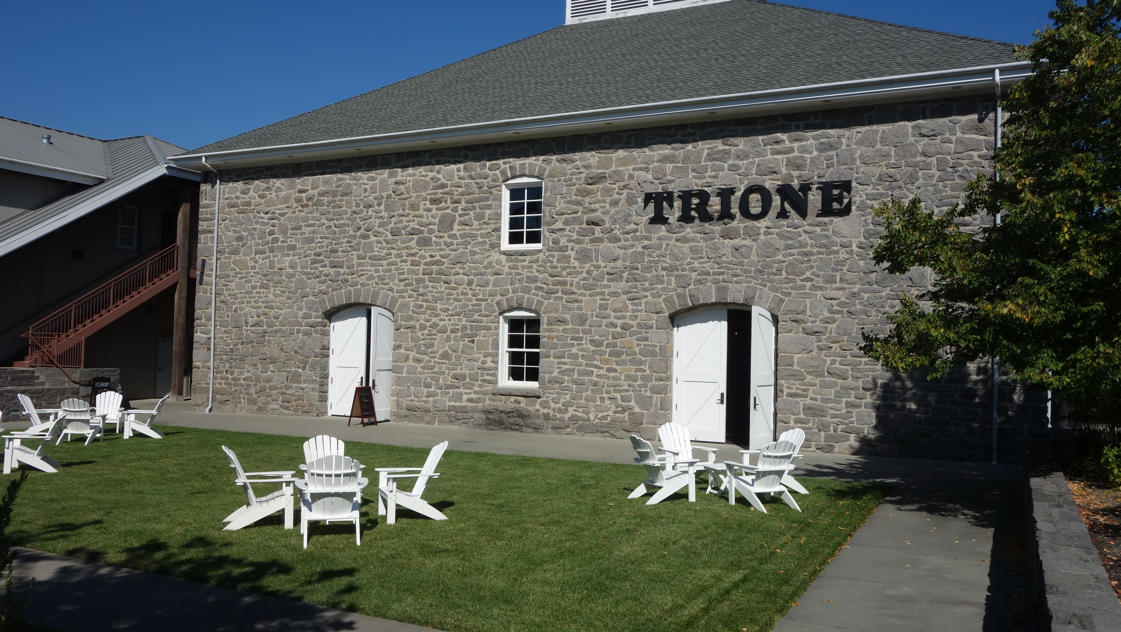
Humboldt Forest

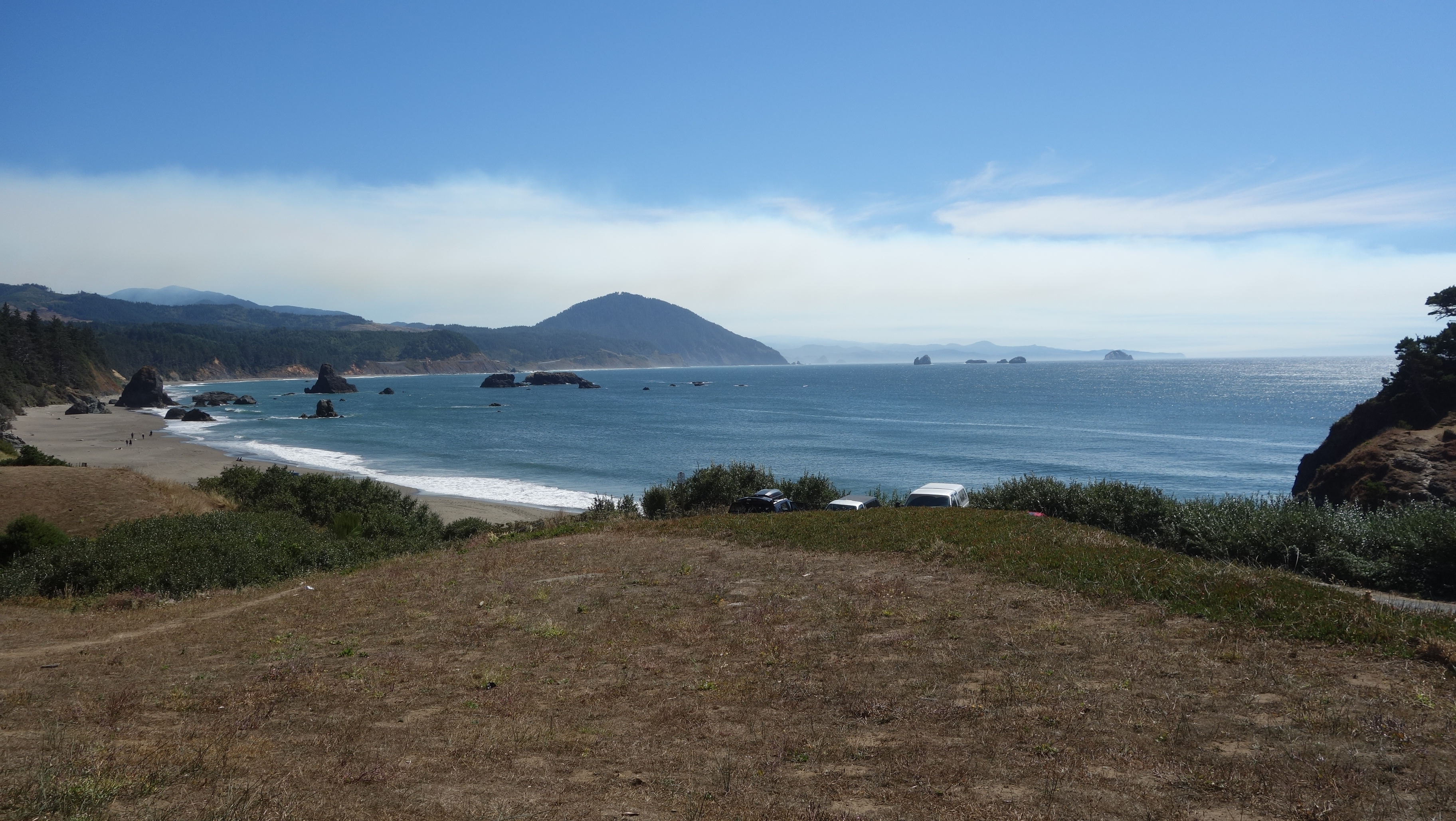
Cell Service Beach, Hwy 1.

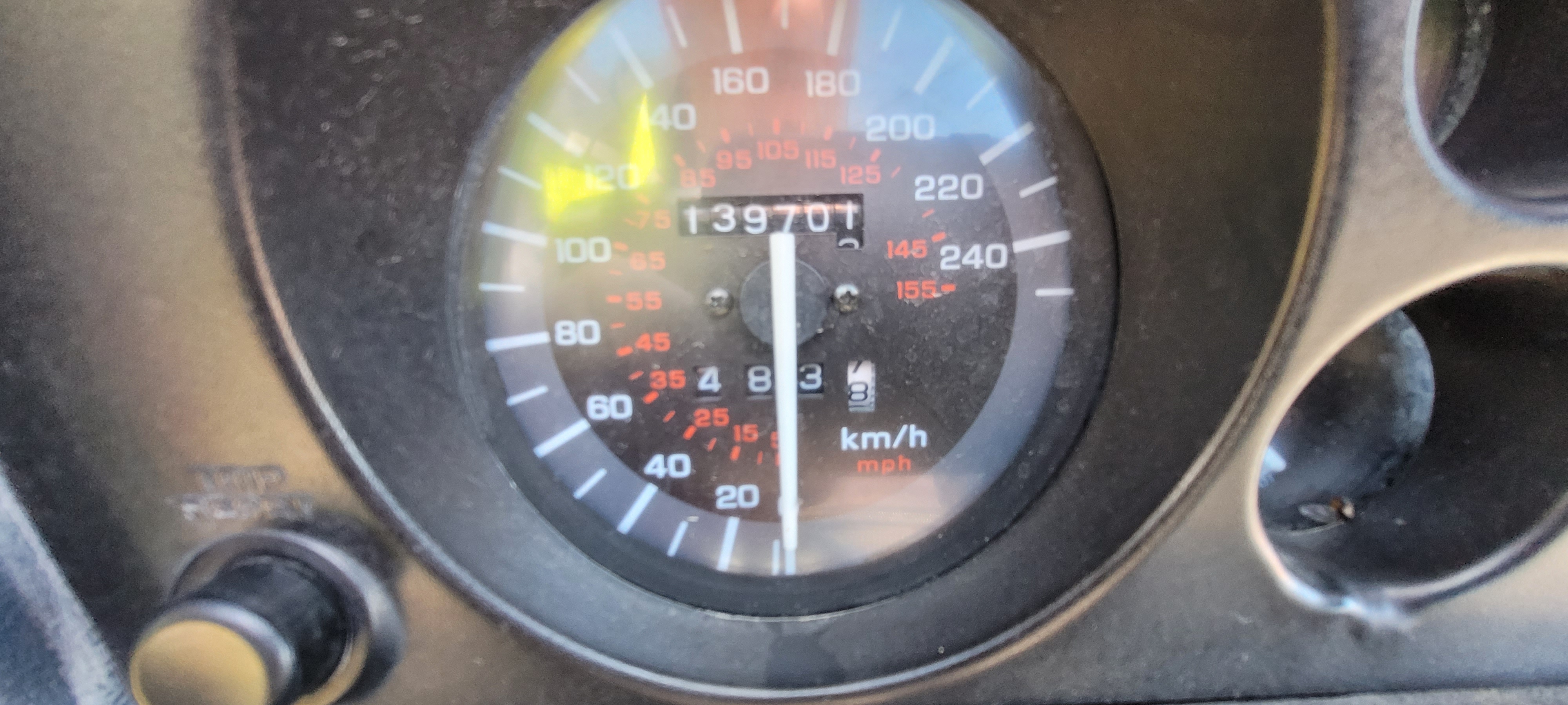
Record distance on one tank.

The convenience store of grace.

The Beach.


The day started out on the grim side as there was a generous dose of London Pea Soup in the vicinity. Definitely not much to see, unless you like grey. Since there wasn’t much point in hanging around in that muck, I just packed my things and loaded up and was on the bike heading out at 8:15 am. Even though it wasn’t raining per se, the air was like rain so I was all geared up for it in my rain suit and rain gloves.

I had been somewhat perplexed by both Google Maps AND my Garmin predicting a six hour ride to MacKerricher, despite the measly 300 km distance. I had planned to stop at the park gate to ask the gals if they knew something that I didn’t but they were still in their jammies tucked under their covers so I pressed forward.

I started out on a little side road that was winding its way through Meg-sue park so I didn’t think anything was up but at a time when I thought it would have been obvious that it was time to turn onto Scenic Byway Cyberdyne 101, the GPS sent me straight on with the road that I was already riding. I don’t always remember which setting I have chosen for the Garmin but I know it is either “fastest route” or “shortest route”. If I am not in a hurry, I will often set it to “shortest” because it will take me off the well-beaten path and often on side roads that are more interesting than the way which would get me there fastest. This is my usual preference. I followed the road and at times, the pavement gave way to gravel but not like in the sense that They couldn’t make up Their minds when They built the road, I think it was leftover damage from the quake in 1905 and it was just too minor a road to worry about repairing. The good news is that this was an out-of-the-way road; so out of the way in fact that other people that I saw on it looked lost. It passed by a couple of quite pretty beaches, the first which was occupied by a lot of people and dogs and such. Keep in mind that it is 8:45 am and there is heavy fog, so it actually made for a very interesting view. Unfortunately, I hadn’t bothered with the GoPro because it was so foggy and it wasn’t safe to stop to take a picture because I was afraid the road was going to fall away into the ocean. But the next opportunity was not lost. Sadly, it wasn’t quite as interesting as the prior beach and clearly, the lost locals knew the same because it was not near as busy as the first I had seen. But I stopped because there was actually a parking area, a little park, benches and stairs down to the water. After I snapped a few pics, on I went and when the Garmin took me under Hwy 101, I smelled something fishy, and not from the ocean. I was committed to climbing a steep, moto-cross type hill but when I got to the top I stopped in somebody’s driveway (the lady driving her car out waived at me as she went by) and checked the setting on the GPS and lo and behold I had it set to “avoid motorways, speedways, interstates, autobahns, roads with six lines or more and people who call me ‘sir’”. It seems Scenic Byway 101 is one of the above in the single eye of the Garmin GPS.  Once I had changed that setting to "Whatever", it was onto slab riding on the motorway, which was, in fact, just a big, fast highway akin to driving between Calgary and Edmonton. I only stopped to change into my “winter” riding gloves at one of the many pull-outs along the way. At this one, though, clearly, nobody was lost.


This went on for a couple of hours and my increasing hunger was making me wistful for something delicious, like a latte. But out in the middle of nowhere on what is basically an interstate there aren’t too many drive-through espresso bars. However, around 10:45 I saw an exit to Myers Flats and there were the symbols on the road sign for places to buy table settings so I figured there had to be some kind of food there. A quick, i.e. 30 second ride through the entire town revealed exactly two places to buy something potentially good: an ESPRESSO bar(!) and a convenience store. There were also a few other non-descript businesses but I wasn’t paying much attention because they were not selling lattes. Not entirely sure who was the consumer base in this forgotten corner of the world but the owner of the espresso bar had told me it had been a busy summer.

Seated outside the espresso bar were two gents, one older and the other younger (than me, of course) with their road bikes. The younger was riding his packed-for-Armageddon touring bicycle, the older, a sleek road racer. The bike, I mean. We start chatting and I had to suffer the indignity of fessing up to yet another Washington tip-over. It’s pretty obvious with only one mirror on the bike so it is not like I can just subtly change the subject. The good thing is that they are both Canadian and on their own versions of U.S. trips. Tim, the younger, is from Montreal and Ed, the older (sorry Ed, because I know you are reading this) is from…. KELOWNA! It’s practically Old Home Week in Myers Flats! Both of these guys are grizzled road biking veterans. But they are not riding together, they just happen to have met for espresso, just like I showed up. Ed is camping four miles down in Humboldt Redwood Forest and implores me to take a ride down there. Tim is riding to the Antarctic, or some place far away. They are clearly chummy and I’m not sure how long they have been sitting there but Tim wants to buy Ed a muffin before he heads off.  Tim is probably in his late 20s and Ed is a couple of generations ahead of him. Actually, Ed might be a couple of generations ahead of me! He tells me he rides… what was it? Something with a “5” in it, like, 50,000 miles a year. Maybe its kilometres. Maybe it’s dog years but it was a lot. They guy is a specimen and if you ever wonder if it is possible to be fit in your “golden years”, Ed is the living, breathing example of it. I’ll see you back in Kelowna, Ed!

And this stop was perfect timing for me because by the time I had finished my go-big-or-go-home latte and bagel with avocado and cream cheese, the sun was shining so I was able to take off my winter wear.

Based on Ed’s advice, I go off down the little side road to visit the Humboldt Redwood Forest. I had come through the Redwood Forest when I first entered California yesterday but there, it was on a fast road with little opportunity to gawk at the trees.  At Humboldt, it is a leisurely pace where there are families riding bicycles and others out on the road. You can see in my one picture the bike between two redwoods adjacent the road, for perspective. These are spectacular trees. Big in this case is really big. 12 feet across, 40 feet in circumference, height to “lower limb” 190 feet. Big in every sense.

A few miles down the highway the Garmin instructs me to turn onto Hwy 1. Though I had looked at this while I was at home, I was unprepared for what awaited me: this was far and away the twistiest, gnarliest stretch of riding I had even done in my entire riding career. Plus, I was low on gas but I didn’t realize it at the time I turned onto it. Adding to the challenge that many segments of road has sand and loose gravel coating the mountain-side (my) lane because the road is cut into side of the sandstone mountain and the stuff just sluffs off every chance it gets. If you have ever been on a motorcycle, check out this Google Maps view: Highway 1 north end. This is only really worth doing if you zoom in real close; better still looking at Google Street View.

I am going over the mountain and as I am climbing in elevation, I notice the gas gauge. It's low: embarrassingly low. Immediately, my anxiety goes up and all of a sudden, what started out as a fun, adventurous ride is now a test of the bike's gas guage. It is solidly on the "E". No fuel warning light, though, which is key because once the light flashes once, I know I have about 50-75 km of range remaining... on flat land. 

I start riding extra conservatively, keeping revs low, coasting downhill as much as practical. There are very few houses out in this area but because it is a well known road, there is a reasonable amount of traffic so i know that should I run out of gas, I won't be without resources. I pull over when it is safe so that I can see if I can determine how far it is to a gas station but of course, there is no cell service. I  have a siphon pump with me however, I have always carried it because I have a large gas tank and should some OTHER motorcycler run out of gas, I am almost sure to have enough to give. Now it looks like it might be the reverse. 


I really have no idea how far it is over the mountain range so now I am just praying I have lived a good enough life. Eventually, I reach the coast after what seems like 20? 40? 60? minutes and there is immediately a roadside turnout and people are pulled over having a look at the view. Even though I don't want to stop the bike, I pull over to check for cell service, which is available and according to Google, the next gas station is 33 miles away in Fort Bragg. Still no fuel light on the bike so I am probably safe at this point. Since I am stopped, I snap a couple of quick pictures and then press on, continuing to ride conservatively. I wave any vehicles behind me to pass. 

After maybe 20 minutes, I am passing through the ocean side community of West Port and there is a convenience store with a sign that says "We have gas". This is well in advance of the Google estimate. I had been watching the trip meter since my last fill: 483 km; I so wanted to see it roll over the 500 km point for one tank but after how I had been feeling, it just didn't seem right. I stop in and announce "I have lived a good life". The owner is there with his little boy Heron and looks at me like I am from


outer space but I think he had some idea what it was about. Gas is US $6.99 a US gallon, about a buck and a half more than a regular gas station. Small price to pay. The gas pump requires me to push the nozzle into the tank in order to make the gas flow but in doing so, only allows me to fill half a tank. Even at that price, I feel like the least I can do is buy a full tank of gas so I have to hold a sleeve on the nozzle back to keep the gas flowing. US $44 for a tank of gas. Cheap. 
I ride another 20 km and then there is another convenience store with gas, so I would have made it. I think I would have made it to Fort Bragg if there hadn't been another opportunity because the fuel light never came on but that would have been another level of anxiety.

I end up riding past the turnoff into MacKerricher because it is not well marked for people on motorcycles with anxiety, so I have a little ride around Fort Bragg, a mere 6 km from the campground. There are all kinds of kids walking around town, which seems odd to me because it is not yet 2:00 pm. Why aren't these kids in school? There is also a street closed because of a farmer's market, which seems odd  to me on a Wednesday afternoon.

At the campground, it is the same routine as the night before, riding around and picking a site then reporting back to the gate to say which one I want. There are several in the area that appeal to me; what i didn't realize is that most of them are reserved so I end up with one, very open site, which is o.k. because I have learned the best thing is to have morning sun so that everything can dry off. I'm a little surprised at the $45 price, since the campground is pretty basic. I can buy a tank of gas for cheaper than that! The picnic tables look like they are about 50 years old, the bathrooms look like they are 50 years old, no soap, no paper towels, coin operated showers and they don't appear to ever have shoveled ash out of the fire pits. Adequate, but basic. What it DOES have is close proximity to the beach. Here I am, riding down the coast and I haven't even been able to set foot yet on a beach somewhere. I was determined because it was my last night on the coast.

After setting up my tent and getting my area organized, I ride back into Fort Bragg for dinner. I am so close to town that I don't see any reason to eat another meal of noodles, dehydrated vegetables and canned meat. It is either a deli with something nice to prepare or a restaurant. Easy choice, and I elect La Palapa, the best rated restaurant at 4.7 stars in Fort Bragg. It is primarily a take out place, though, according to the sign inside, has seating for 39 but there is a steady stream of take out customers while I am there.  

When I get back to camp, I am motivated to get to the beach before it gets dark. My plan is to call Nan from there so that she can see it. My next door neighbour Russell is also determined... to talk to the guy with the motorcycle. He immediately comes over to visit and likes to talk. However, as much as I would like to visit, because that is what this is about, I beg off and tell him I am going to the beach to call home. Already the shadows are long so I don't want to be doing it in the dark. 

It is a short walk, which pleases me, after my experience at Fort Stevens. It is a beautiful beach, lots of seals about and I think to myself it would be fun to swim just to say I had done it. I pull my pant legs high and let the water waves wash over me feet. 

It's freezing.


Day 7: Sue-meg State Park

 Distance traveled: 310.8 km

Cumulative distance: 1989.1 km

Maximum speed: 123 kph ("freeway")

Moving average: 73 kph

Temperature range:  16.2 - 25.2

I was up from 4:00 a.m. to 6:00 a.m. listening to my next door neighbour’s dog crying her eyes out. Don’t get me wrong, I love dogs, but how is it that the dog’s parents couldn’t hear her yet REST of the campground could. But I did go back to sleep and woke up after 7. I took my time to get organized,

after all, it wasn’t raining so why the rush? I draped the fly over some bushes and stood the tent on its end with the side panels open to get some air through, and everything else was draped over the picnic table. It took about three hours for things to be dry enough to pack up, which was helped by the sun coming through the thick Douglas firs behind me.

Scenery wasn’t quite as good today; it seems like the Hwy 101 sweet spot is between Fort Stevens and Charleston. Maybe make a note of that if you think you might come down here. Nonetheless, it was still worthy, especially at lunch time when I broke down for an all-American breakfast: BELGIAN waffle with eggs, bacon and syrup. In a classic all-American diner that included a counter. After I ate, I spent a long time on the phone ordering a mirror for the bike and sorting out a destination for tonight. So long in fact, the waitresses, only slightly older than my mother, thought I was moving in with them. But I got a mirror ordered and so now I am making a side trip through 

Sacramento, and I determined a destination for the night. Sadly, California state campgrounds do not allow same-day or even next day reservations. They don’t care that I am riding a motorcycle and don’t know up from down, right from wrong or what is going to happen over the next few hours let alone days.

One spectacular scene today was driving through the redwood forest. I realize this is lame talk about something and not have a picture but it comes with the territory on this trip. The only photos of the redwoods I managed were with the GoPro camera on top of my helmet and I need stronger cell service to get those pictures. The road is twisty but the forest is so thick and the trees so tall I needed to turn on the high beam on the bike to help me see. Because I was wearing sun glasses. I need to look cool going through the forest. But it was dark in there. 

I found the campground, which is one of several in the Sue-meg state park. When I pulled up to the gate, I asked the attendant "who was Sue Meg?" She told me it is a Yurok (local First Nation) word for “always there”. 

There is a bit of the funky chicken for picking a camp spot. They wouldn’t let me make a reservation, so I had to take a plasticized sheet showing all of the four (six?) campgrounds with a green highlighter indicating which spots were open. My job, while holding the card, was to ride around and pick THREE tent sites because other people were doing the same thing and somebody else might pick the spot that I pick before I get back. I only dropped the card one time, and had to find a level spot to park where the bike would lean sufficiently in the correct direction, then run back and retrieve the card. I picked a long, narrow deep camp site so that in the morning, the sun should shine in and help me dry my stuff if there is a lot of dew, though it seems drier here than the other places I have camped on this trip. Mainly because it is not raining.

I actually wanted this particular campground because it was the closest to the beach however, when I went for a walk thinking I would visit the beach, I discovered I would need to take a couple of days to include that in my itinerary because I am 50 vertical metres above the beach but the view is spectacular. I sent this picture to Nan and she asked me if that was the view from my tent site. Sadly, no it is not but if it was, I would stay an extra day.

Agate Beach.

One other thing: I was warned that there are both bears AND cougars in the park. There are metal storage bins in each tent site and at the gate, I was told to use mine. I was putting away my dinner items like cooking pot, stove, almonds but wasn't all that fussed as i was talking to Nan on the phone, when I heard a rustle behind me. I just about jumped out of my skin. I struggled to get my headlamp lit and when I did I saw a HUGE mountain lion staring me in the face! It had a bandit mask, dark muzzle, grey features and actually looked kinda cute. I yelled "shoo!" before it made off with my almonds. I saw on one sign around here that said if attacked by a bear or cougar, FIGHT BACK. I'll be more ready next time.

Day 6: Sun Bay State Park, near Charleston, Oregon

 Distance traveled: 410.0 km

Cumulative distance: 1,678.3 km

Maximum speed: 112 kph

Moving average: 65 kph

Temperature range: 15.8 - 21.0

Editor's note: pictures are taking 75 seconds to upload, so I am saving many for better cell service.

Rumours of my death are greatly exaggerated! I am simply without cell service! I'm having lunch in Bandon, Oregon. Unfortunately, my computer had.not charged enough to do an upload, so hopefully tonight.  I am keeping it up, though saved on my computer. 

Here are couple of pictures from my phone:


My lunch time view from yesterday.

I woke this morning to the sound of rain pelting the tent. This was at about 5:30 am so I just waited hoping to go back to sleep or for the sun to come out and just warm and dry everything out! Well, none of that happened so as I could hear the campground start to come alive, I decided to treat myself to a shower and put on all fresh clothes for the day!

Despite my best efforts, everything is wet. Some of this is just from striking the tent but I just could not manage to keep anything dry, even though the inside of the tent was relatively dry. The tent, fly, groundsheet (which was now covered in sandy mud) all weighed an extra 10 kilos (22 pounds). Since I had a water tap at my tent site, I tried washing some of the sand off but I didn’t have enough hands to make it work. Where is a pillion when you need one?

Since I did not bother with doing a tidy fold of the tent gear, I was packed and rolling out of my tent site, dressed in my rain gear at the princely hour of 8:15. It must be some kind of record.  I rode through Loop C to say goodbye to Peter  and looked for what I thought might be his van but there was no sign of life. How civilized.

Rather than hit the highway right away, I rode around the park for nearly an hour looking at some of the sights. There were some old bunkers from WW II and as well, some artillery including deactivated ordinance but some of this stuff was inaccessible due to road construction.


Given that I was going so early, I resolved to stop at the first drive-through espresso bar I saw, which happened to be about 9:30. Drive-through espresso bars are very common down here. I couldn’t actually drive through because I wouldn’t be able to hold a latte while driving so I ended up walking to the window. I also ended up spending an hour messaging back and forth with a person back home who wanted to buy my wine shipping containers, which I had posted on Facebook Marketplace, in exchange for a donation to the women’s shelter. Nan will be handling that back home.

What yesterday lacked in view was more than redeemed today. It just got better and better as the day wore on. When I post this and actually see the pictures, I think I’ll let the pictures do the talking.

At one point, there was a side road between Hwy 101 and the ocean and on a lark, I went down it as it did not say “dead end” so I figured it would have to join the highway again at some point. The road led to more spectacular views, perhaps missed by those on the highway, and then turned into a one way road. I stopped at a viewpoint and was chatting to a gal from Kentucky and I told her I expected to be down there next year. We talked about what was good about Kentucky and she said the camping is great, horse farms, flowers in the spring and the Appalachians. She then said just the education is bad.

I stopped in Lincoln City for lunch when I saw a place called Kyllio’s Seafood Bar. I figured I better eat some seafood while I am on the coast so I ordered the Dungeness linguini. I somehow overlooked that it would come in a litre quart of whipping cream. There was also some tiny green flecks in it. I think they might have been broccoli. I still ate it.

The restaurant had a pretty good beach view so after eating, I took some time to look for a destination for the night and ended up booking the Sun Bay campground. With the knowledge in hand that I could take as long as I wanted without worrying about being homeless, I made a lazy effort and stopped at multiple viewpoints to take in the gaze and maybe some pictures. I can tell you that I missed photographing millions of beautiful vistas simply because there was no safe place to stop or I was too busy with the road. But it would be worthwhile doing this trip a few times and maybe more slowly. I saw numerous people riding bicycles with packs on them and as well, I saw a total of three people walking with backpacks on the highway. That’s dedication.


I also crossed over a spectacular bridge coming into this town and so I was determined I would try to find a spot that I could photograph it. I ended up above the airport looking over the bay with the bridge as well as another bridge that had a centre-swivel to allow boats through. I suspect this was a rail bridge. I had never actually seen one of these but I remember as a tyke 60 years ago that I had a toy train set with such a bridge on a swivel.

When I passed through the last city before my camping destination, I thought I might look for


something green to eat so I stopped in at Safeway and grabbed an endive salad for dinner. I didn’t need much because I still have a lump in my stomach from lunch but I thought maybe some type of vegetable might be good.

I had set my GPS to find the campground and I was a little surprised when it took me well past Charlston until it told me as I was at my destination when in fact, I was not. This was a somewhat rude awakening, so I pulled over and looked at my phone, which initially said “no service” However, after a minute that rectified itself and I was able to determine that the campground was on the correct road but Garmin had just misplaced it by a couple of kilometres.

Unbelievably, I rolled into my tent site at exactly 7:00 pm, a total of nearly 11 hours on the road. I knew my camping gear was going to be wet but I underestimated what it was going to take to dry. It was sopping. I should have opened it up and towed it behind me like a parasail. Iput all the poles in the tent so that it would be expanded as much as possible and waved it through the air like some big balloon and though I suspect it helped, the inside was nowhere near dry. I didn’t care so much about the fly since it should not touch the tent, if I do a good job getting it tight.


Epilogue: more photos

  Week 1 Beach at Fort Stevens. Surfers at Fort Stevens. Nuts! Fort Stevens military lookout. Random small town buildings. Crab fishermen. S...