Day 3: Clallam Bay, Washington (I can see Canada across the
Juan de Fuca Straight!
Distance traveled: 233.9 km
Cumulative distance: 750.4 km
Maximum speed: 112 kph
Moving average: 61 kph
Temperature range: 14.0 – 25.8 but at times, when it was the
low 20s, it felt 10 degrees cooler.
Editor’s note: Somebody said “hello” to Rob in the comments.
To whomever, Rob says “hello” back!
This morning, despite being relatively organized, it was a
10:30 am departure from Rob’s place. We spent the morning visiting and
discussing the best way for me to get to the Edmond – Kington Ferry and whether
or not his cat was a male or female. I had picked up the ferry schedule and I
was targeting the noon sailing and I didn’t foresee an issue as it really
wasn’t terribly far; maybe 30 km through Seattle traffic so I figured I was
safe to skip the interstate… and stay safe.
To my surprise, it was surprisingly warm at 21 degrees after
it had been only 13 a few hours before. I was dressed for a cool ride with
jeans and a Canadian Olympic Motorcycle Touring Team jacket. I enjoyed a fairly
civil ride through Seattle side streets and at one point, again I was riding
alongside the interstate but I wasn’t feeling too anxious. However, at about
11:30 I checked the anticipated arrival time at the ferry and the GPS forecast
11:50 am. I wasn’t going to make it. Nonetheless, I remained pretty stress free
about it all. It would mean an extra hour wait so I started to consider one of
my other tasks, which has been to pick up a domestic SIM card for my phone. I
was bound and determined not to get bent out of shape about the time and just
allow myself to take it as it comes. But I didn’t see a suitable place to get
the SIM card, so before I knew it, I was arriving at the ferry terminal LINE
about high noon. This looked gross, like a two sailing wait, so I dutifully got
in line and turned the bike off. Within about a minute, the driver of the car
behind me was standing beside my bike and helpfully told me that motorcycles
don’t need to wait in line, I could just drive to the front of the line and buy
my ticket. Suddenly, the departing ferry was becoming more of a possibility so
I raced ahead, hoping I understood his directions correctly.
I rode up to the gate and the attendant told me I had to go
inside the neighbouring building to buy a ticket so I left my bike parked in
the motorcycle lane, raced inside and looked frantically around for the place
to buy the ticket. There were two unattended machines there and I thought,
“great, now I have to figure these out in a hurry” but then I spotted a wicket
at the far end of the terminal. I hurried down to the wicket and the attendant
deducted US $9.20 from my retirement savings and told me I was going to make
it.
By the time I got back to my bike, cars were already loading
so I wasn’t sure if I was going to be allowed but I loaded last and was sent up
a ramp that would lead me to the front of the ferry. I guess all the cars in
line were waiting for a different ferry, likely Whitby Island. Unlike BC
Ferries, there were no signs indicating for which ferry cars should line up. Or
at least, that I could see. Departure time ended up being about 12:20 or even
later so I am not sure if it was late or I was just wrong about the schedule
but it all worked out.
I just stayed on the car deck and tended to my electronics.
Making sure I had a good battery in the camera and that I had the correct
things charging. Honestly, I am not OCD about the electronics, I am just making
up for not having my photographer along.
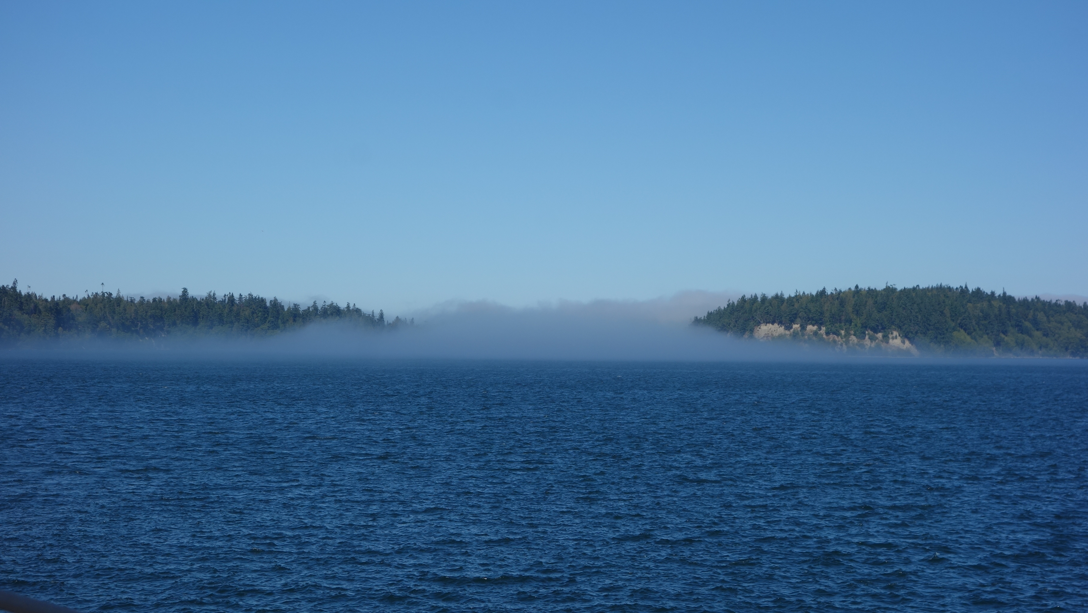
There was a fair amount of fog about this morning. Despite
it being sunny in Seattle, there was fog all the way across Puget Sound and the
ferry’s horn was frequently sounding to warn other craft that we were likely
way bigger and they would be better off getting out of our way.

After a respectable crossing time, which I believe was
accelerated due to the late departure, I was crossing into Kingston and once
again, looking for a suitable place to buy a SIM card, in part, because I had
no other real destination in mind. I wanted to go through Port Angeles but
other than that, I really had no idea where I was going.
After Port Angeles, the road got a little more interesting and when I passed an intersection of Highway 101, upon which I was traveling and Highway 112, I stopped the bike and looked at Google Maps just to double check where 112 went and on a lark, turned the bike around and went down 112. Immediately, the road became much more interesting so I was promptly rewarded.

Then I happened upon an intersection and I stopped the bike
to look up where the respective roads went and what prospects I might have for
camping. Turning left would take me back to the famed Highway 101, which will
ultimately take me down the coast, and right would be to No Man’s Land BUT,
also Sam’s Trailer Park. I bet THAT would be a good place to camp and it is
probably on the water.
Well no, it does NOT look like a good place to camp. It
looks like a homeless camp so I kept going a little further and into Clallam
Bay. There is a sign that says Visitor Information and I figure it is about
time to ask for some guidance. However, it is not clear where the Visitor
Information is located so I go into the co-op store there and a kindly elderly
(“older than me”) lady working in the store tells me that the county hasn’t
bothered to move the visitor information sign and the store likes it that way
because more people come inside.

 |
| The Co-op store where Howie met Sally. |
As I finish this off tonight, the fishermen and women are
all tucked in their beds. It is 9:20 pm and the people across the road have
shut off their music. My next door neighbour, all of 5 feet away, tells me they
will be up at 4:00 a.m. to head out to fish for Coho salmon tomorrow. I’ll try
to sleep in.
BTW, it’s 11 degrees our here. Pictures will have to come Saturday morning since my computer was too tired to go on.

 |
| Camping location. |

 |
| Elk in a farmer's field. |


