Day 7: Sue-meg State Park

 Distance traveled: 310.8 km

Cumulative distance: 1989.1 km

Maximum speed: 123 kph ("freeway")

Moving average: 73 kph

Temperature range:  16.2 - 25.2

I was up from 4:00 a.m. to 6:00 a.m. listening to my next door neighbour’s dog crying her eyes out. Don’t get me wrong, I love dogs, but how is it that the dog’s parents couldn’t hear her yet REST of the campground could. But I did go back to sleep and woke up after 7. I took my time to get organized,

after all, it wasn’t raining so why the rush? I draped the fly over some bushes and stood the tent on its end with the side panels open to get some air through, and everything else was draped over the picnic table. It took about three hours for things to be dry enough to pack up, which was helped by the sun coming through the thick Douglas firs behind me.

Scenery wasn’t quite as good today; it seems like the Hwy 101 sweet spot is between Fort Stevens and Charleston. Maybe make a note of that if you think you might come down here. Nonetheless, it was still worthy, especially at lunch time when I broke down for an all-American breakfast: BELGIAN waffle with eggs, bacon and syrup. In a classic all-American diner that included a counter. After I ate, I spent a long time on the phone ordering a mirror for the bike and sorting out a destination for tonight. So long in fact, the waitresses, only slightly older than my mother, thought I was moving in with them. But I got a mirror ordered and so now I am making a side trip through 

Sacramento, and I determined a destination for the night. Sadly, California state campgrounds do not allow same-day or even next day reservations. They don’t care that I am riding a motorcycle and don’t know up from down, right from wrong or what is going to happen over the next few hours let alone days.

One spectacular scene today was driving through the redwood forest. I realize this is lame talk about something and not have a picture but it comes with the territory on this trip. The only photos of the redwoods I managed were with the GoPro camera on top of my helmet and I need stronger cell service to get those pictures. The road is twisty but the forest is so thick and the trees so tall I needed to turn on the high beam on the bike to help me see. Because I was wearing sun glasses. I need to look cool going through the forest. But it was dark in there. 

I found the campground, which is one of several in the Sue-meg state park. When I pulled up to the gate, I asked the attendant "who was Sue Meg?" She told me it is a Yurok (local First Nation) word for “always there”. 

There is a bit of the funky chicken for picking a camp spot. They wouldn’t let me make a reservation, so I had to take a plasticized sheet showing all of the four (six?) campgrounds with a green highlighter indicating which spots were open. My job, while holding the card, was to ride around and pick THREE tent sites because other people were doing the same thing and somebody else might pick the spot that I pick before I get back. I only dropped the card one time, and had to find a level spot to park where the bike would lean sufficiently in the correct direction, then run back and retrieve the card. I picked a long, narrow deep camp site so that in the morning, the sun should shine in and help me dry my stuff if there is a lot of dew, though it seems drier here than the other places I have camped on this trip. Mainly because it is not raining.

I actually wanted this particular campground because it was the closest to the beach however, when I went for a walk thinking I would visit the beach, I discovered I would need to take a couple of days to include that in my itinerary because I am 50 vertical metres above the beach but the view is spectacular. I sent this picture to Nan and she asked me if that was the view from my tent site. Sadly, no it is not but if it was, I would stay an extra day.

Agate Beach.

One other thing: I was warned that there are both bears AND cougars in the park. There are metal storage bins in each tent site and at the gate, I was told to use mine. I was putting away my dinner items like cooking pot, stove, almonds but wasn't all that fussed as i was talking to Nan on the phone, when I heard a rustle behind me. I just about jumped out of my skin. I struggled to get my headlamp lit and when I did I saw a HUGE mountain lion staring me in the face! It had a bandit mask, dark muzzle, grey features and actually looked kinda cute. I yelled "shoo!" before it made off with my almonds. I saw on one sign around here that said if attacked by a bear or cougar, FIGHT BACK. I'll be more ready next time.

Day 6: Sun Bay State Park, near Charleston, Oregon

 Distance traveled: 410.0 km

Cumulative distance: 1,678.3 km

Maximum speed: 112 kph

Moving average: 65 kph

Temperature range: 15.8 - 21.0

Editor's note: pictures are taking 75 seconds to upload, so I am saving many for better cell service.

Rumours of my death are greatly exaggerated! I am simply without cell service! I'm having lunch in Bandon, Oregon. Unfortunately, my computer had.not charged enough to do an upload, so hopefully tonight.  I am keeping it up, though saved on my computer. 

Here are couple of pictures from my phone:


My lunch time view from yesterday.

I woke this morning to the sound of rain pelting the tent. This was at about 5:30 am so I just waited hoping to go back to sleep or for the sun to come out and just warm and dry everything out! Well, none of that happened so as I could hear the campground start to come alive, I decided to treat myself to a shower and put on all fresh clothes for the day!

Despite my best efforts, everything is wet. Some of this is just from striking the tent but I just could not manage to keep anything dry, even though the inside of the tent was relatively dry. The tent, fly, groundsheet (which was now covered in sandy mud) all weighed an extra 10 kilos (22 pounds). Since I had a water tap at my tent site, I tried washing some of the sand off but I didn’t have enough hands to make it work. Where is a pillion when you need one?

Since I did not bother with doing a tidy fold of the tent gear, I was packed and rolling out of my tent site, dressed in my rain gear at the princely hour of 8:15. It must be some kind of record.  I rode through Loop C to say goodbye to Peter  and looked for what I thought might be his van but there was no sign of life. How civilized.

Rather than hit the highway right away, I rode around the park for nearly an hour looking at some of the sights. There were some old bunkers from WW II and as well, some artillery including deactivated ordinance but some of this stuff was inaccessible due to road construction.


Given that I was going so early, I resolved to stop at the first drive-through espresso bar I saw, which happened to be about 9:30. Drive-through espresso bars are very common down here. I couldn’t actually drive through because I wouldn’t be able to hold a latte while driving so I ended up walking to the window. I also ended up spending an hour messaging back and forth with a person back home who wanted to buy my wine shipping containers, which I had posted on Facebook Marketplace, in exchange for a donation to the women’s shelter. Nan will be handling that back home.

What yesterday lacked in view was more than redeemed today. It just got better and better as the day wore on. When I post this and actually see the pictures, I think I’ll let the pictures do the talking.

At one point, there was a side road between Hwy 101 and the ocean and on a lark, I went down it as it did not say “dead end” so I figured it would have to join the highway again at some point. The road led to more spectacular views, perhaps missed by those on the highway, and then turned into a one way road. I stopped at a viewpoint and was chatting to a gal from Kentucky and I told her I expected to be down there next year. We talked about what was good about Kentucky and she said the camping is great, horse farms, flowers in the spring and the Appalachians. She then said just the education is bad.

I stopped in Lincoln City for lunch when I saw a place called Kyllio’s Seafood Bar. I figured I better eat some seafood while I am on the coast so I ordered the Dungeness linguini. I somehow overlooked that it would come in a litre quart of whipping cream. There was also some tiny green flecks in it. I think they might have been broccoli. I still ate it.

The restaurant had a pretty good beach view so after eating, I took some time to look for a destination for the night and ended up booking the Sun Bay campground. With the knowledge in hand that I could take as long as I wanted without worrying about being homeless, I made a lazy effort and stopped at multiple viewpoints to take in the gaze and maybe some pictures. I can tell you that I missed photographing millions of beautiful vistas simply because there was no safe place to stop or I was too busy with the road. But it would be worthwhile doing this trip a few times and maybe more slowly. I saw numerous people riding bicycles with packs on them and as well, I saw a total of three people walking with backpacks on the highway. That’s dedication.


I also crossed over a spectacular bridge coming into this town and so I was determined I would try to find a spot that I could photograph it. I ended up above the airport looking over the bay with the bridge as well as another bridge that had a centre-swivel to allow boats through. I suspect this was a rail bridge. I had never actually seen one of these but I remember as a tyke 60 years ago that I had a toy train set with such a bridge on a swivel.

When I passed through the last city before my camping destination, I thought I might look for


something green to eat so I stopped in at Safeway and grabbed an endive salad for dinner. I didn’t need much because I still have a lump in my stomach from lunch but I thought maybe some type of vegetable might be good.

I had set my GPS to find the campground and I was a little surprised when it took me well past Charlston until it told me as I was at my destination when in fact, I was not. This was a somewhat rude awakening, so I pulled over and looked at my phone, which initially said “no service” However, after a minute that rectified itself and I was able to determine that the campground was on the correct road but Garmin had just misplaced it by a couple of kilometres.

Unbelievably, I rolled into my tent site at exactly 7:00 pm, a total of nearly 11 hours on the road. I knew my camping gear was going to be wet but I underestimated what it was going to take to dry. It was sopping. I should have opened it up and towed it behind me like a parasail. Iput all the poles in the tent so that it would be expanded as much as possible and waved it through the air like some big balloon and though I suspect it helped, the inside was nowhere near dry. I didn’t care so much about the fly since it should not touch the tent, if I do a good job getting it tight.


Day 5: Fort Stevens State Park, Oregon

Distance traveled: 323.0 km

Cumulative distance: 1,258.3 km

Maximum speed: 114 kph

Moving average: 78 kph

Temperature range: 14.8 - 26.2

Editor's note: it is taking 75 seconds to upload one picture. You lose.

No update tonight because there is no cell service at the campground (at least where I am situated). However, I am out for a robust walk (a little more robust than I was anticipating!) and I was checking my phone to call the park to get airlifted and discovered I have three bars here. I'll be saved!

In there interim, here is one picture from my walk.


My hostel camp was a success. My host Jimmy was quite gracious about having me move in without his prior knowledge. I woke up about 7:00 am and shortly afterwards, I heard him heading out to his big corrugated metal shed so I just called out “Good morning Jimmy!” so that he would know that I was awake. But the night before when I went out just before turning out my light, I noticed that there was a light on inside the shed. I’m out in the middle of nowhere, I don’t know anybody and nobody knows where I am (unless you checked Spotwalla) and I couldn’t help but wonder if that is where Jimmy kept the college co-eds. That happened to a friend of a friend of mine.

I had initially resisted Jimmy’s offer to take a shower but on second thought, I decided this might be an opportunity and while I didn’t want to put Jimmy out, especially because of my being unexpected, it was his “business” so I thought I would avail myself. I went into the house to clean up and he told me that pressure tank is out of order so there is no water pressure. And thus, no shower. He had put out a basin of water for me to wash my face. So much for that idea. We’ll see where the next shower shows itself.

He did invite me to eat some breakfast, which was a bonus. He had “won” four dozen two-days-from-expiring eggs at the Tribal elders dinner the night before so there were plenty of eggs in inventory. He had cooked his eggs already so I just cooked three eggs in the grease that he had already used. He also offered me toast, which I declined. I didn’t want to eat all his precious rations aside from which, Jimmy is not much of a house keeper; I don’t think the dish towel has ever been washed so cooking food in his kitchen was a bit of a leap of faith. There was still food stuck to the fork that I ended up taking from the drawer.

I don’t think Jimmy has too much money but he is clearly not destitute. He had just paid somebody $500 to bury the electrical line to his house. But part of the price to stay is to get a lecture that is politically oriented, amongst other things and he freely acknowledged (warned) me of that when we first met.

The last thing at the Rainforest Hostel is to do my chores. I had said to him that in my youth when I hosteled, it had always been an expectation that the hosteler had to make a contribution of chores to help keep the place going and he said that was the expectation here, too, so I helped him stack firewood in his wood shed. It was pretty light work for me but Jimmy is (a spry)  80 so I think he appreciated it. He also instructed me to take some wood into the house. There was some wood that was rotting a little and full of bugs so he didn’t want it in the wood bins because the bugs would get into the other wood. So he had me put it on the woodpile in his living room.

It pains me to say this but today’s ride was pretty dull. The first hour and a half was through endless forest with only two brief views of the ocean. I stopped to take a couple of pictures but these are nowhere near the standard from the other day. I rode through a city called Aberdeen and it only heightened my pain as it was absolutely butt ugly, save for one redeeming feature: a billboard advertising the International Mermaid Museum.

I finally stopped for lunch at a restaurant as I was craving some vegetables or leafy greens as I had not had a vegetable, let alone a salad since Thursday night. I stopped in a logging town called Raymond and went into the first place that looked like a diner. I saw “chicken and bacon salad” on the menu so I figured that would satisfy my craving for something remotely healthy. Even though there were several gals around making themselves busy in a somewhat quiet restaurant, I waited quite a long time before someone came to take my order. The guy looked like the dishwasher… the dishwasher’s homeless brother. The guy was wearing dirty pants, a dirty tank top and a ball cap over his mop of bright red hair. I figured he was a cook just hanging out outside of the kitchen waiting for something to do until my order came and he availed himself of the TV to watch a football game. He took my order, fetched me another glass of water and kept an eye on me when there was a commercial in the game. Deep fried chicken salad is what it was. At least it TASTED good, even if not that healthy. But how healthy do you want to be? Turns out the waiter/cook/dishwasher/homeless guy is the restaurant’s owner.

With cell service I was able to target a campground and now that the weekend is done, I figure I shouldn’t have too much trouble. I also pick one fairly close so I should get there about 3:30 pm. As it happens, the Fort Stevens State Park campground does have vacancy but only for motorhomes requiring power and water. For $44. Which I have to pay in cash because my Canadian credit cards won’t work. Whatever. I’m tired of riding and I don’t want to risk being unable to find a place later. And there is no cell service.

So here I am, in amongst all the trailers and motorhomes, with only a sand pad to set up my tent, which I decide is probably a good thing since it won’t be so wet in the morning. After I set up my tent and get my clothes for tomorrow organized (it’s a clean clothes day!) I decide to go for a walk to the beach. I started out walking in my motorcycle boots but it occurs to me that I’ll regret even a short walk in those boots so I go back to the campsite to change into runners. This will be better on the beach at any rate.

I ASSUMED the beach would be just across the road, beyond the campsites over there so I wasn’t expecting much of a hike. It was only one mile so good thing I changed my footwear. On the beach, there is the derelict of an old shipwreck from 1905. The Peter Iredale foundered there in a storm and was later sold for scrap and what you see is all that remains. From the beach I decide to walk to the

Russel Battery, an old military installation with bunkers and some artillery with some parts dating back to the civil war. However, the walk seems to be extraordinarily long. I walk about two more miles and come to a sign that say it is 2.2 miles away, so I keep walking. In a little while, I discover the aforementioned cell service then keep walking After about another mile, I come to a sign that says 1.1 miles to the battery and 1.4 miles to the campground. Meanwhile, the shadows are starting to get longer. I come to a fork in the road and NO INDICATION which is the right path. I knew that the battery is not on the same path as the campground so I am starting to think I could be out here in the dark trying to find my way. I pick a way, then second guess myself and go down the other path, then start thinking about how dark these woods are getting so I decide to call for directions. I was thinking how lucky to have cell service here. I find the ranger’s office and describe my situation, that I am out for a walk and it is getting dark (it’s 7:00 p.m.) and I need to know which path to take. As I am describing my surroundings, and I have a good landmark which is a bunker that was at the intersection,
though that didn’t seem to be too helpful to the ranger, a fellow came walking with his dog and I really thought this time I’M SAVED! I ask him if he knows the way or if he is just following his dog but he does know so I ditch the ranger and say I’M SAVED! I felt a little sheepish about barging in on the person’s private walk with his dog and I probably looked a little… flustered. Peter, my benefactor with his dog Libby are from Santa Cruz and just out camping for a few weeks. He is clearly a strong walker as the two of them are keeping a good stride. Libby isn’t remotely fussed about the pace, which I find amazing for such a little dog, especially as they have been out about as long as I have.

Turns out we have a number of things in common and he is an extremely affable person. I got some tips on places to visit further along my journey, including a Mobile gas station that serves great food and occasionally has live music. I’m not sure if that place is directly on my path but if it is not, I’ll make an effort to get there.


Day 4: South of Forks, Washington

 Distance traveled: 189.4 km

Cumulative distance: 935.3

Maximum Speed: 114 kph

Moving average: 60 kph

Temperature range: 13.4 -27.0

I had planned to disparage my next door neighbours for all their talk about getting up at 4: 00 am to go fishing because when I got up at 5:20 there was no sign of activity. Nor was there any time after that up until the time when I left the campground so I guess they were good to their word. I'm surprised I didn't hear them but I certainly heard other campers at 5:20! And since I was awake, I didn't see much point in trying to go back to sleep because the campground got very busy in short order. Even at that hour, there was an endless stream of people launching their boats or getting their trucks parked or trailers or whatever. 

This place isn't a typical "tourist" place, it is one devoted to campers who like to fish.  The place smells pretty strongly of fish because the scraps are thrown into the water right there, camp sites are only a few feet apart so motor homes and trailers are packed in tight but nobody seems to mind. Everybody there is doing the same thing and enjoying themselves. I reiterate I was invited to the pot-luck tonight so Sally and her family obviously know people around. People there are do-it-yourselves-fish-charterers and it is clear that everybody is there for the same thing. From almost the moment I was up, there was a steady stream of boats launching or going out to sea. I could sometimes see three or four boats at a time heading out.


My new best friend Sally had offered me her park pass to visit Cape Flattery up past Neah Bay. I had thought about it the night before but this morning, since I was up early, it just made sense to get up there in the morning light. First however, I had to get the camping gear a bit drier and I then needed to pack up. It was a vigorous start to the morning with the temperature at a balmy 6 degrees and everything soaked like it had just been in a monsoon. It was clear all night and the dew showed it.

It was a pleasant ride up to Neah Bay as there were many fishing boats out as well as some tugs pulling barges, freighters and a couple of cruise ships all going through the Juan de Fuca Straight. Foggy in places but not so foggy that my view or vision was at all impaired.
The park is at the end of the world. I was told twice that Flattery Point is the highest latitude part of the continental U.S. A. Somebody can fact check that but it looks likely as it is right around the 49th parallel.

Sally's park pass got me an easy admission and when I got to the end of the road and parking lot, I disrobed my moto gear, extruded my tank bag backpack straps and hiked the short distance through rain forest to the end of the earth, about 15 minutes.

I was treated to the following scene on the way down. One of the most beautiful I have seen.
The view of the lighthouse at the point is the view that people are ostensibly coming to see but I think these other scenes are at least comparable.


I spent an hour at the park. It would be great to spend a few hours watching the changing light. I did have the good fortune to be there as the fog was lifting.

I can't believe my good luck at having met Sally because it is unlikely I would have made the trip out to the point. This was as good as it gets. I saw her briefly when I went back to the campground and to her place to deposit the park pass in the agreed upon spot. I had also dropped off my two dry bags in her yard and she was quickly off on another errand (of mercy, no doubt) but after she left and as I was packing the bike, the rest of her family returned from fishing. Her brother showed me pictures he had taken that morning of a pod of humpback whales that had visited them while fishing. The whales had come as close as about 20 feet. It was quite spectacular. 


I hope this does not become a pattern but by about 3:30 pm I was looking for a camp spot without much luck. I visited a couple of state camp grounds that were full, turned off the highway to a couple of others but it was unclear if they were five km or fifty km away so turned back, then decided to investigate a promising spot off the highway. It looked suitable, flat, not too rocky and trees around to hang food. However, I also discovered, as I walked around inspecting the prospects, a large pile of reasonably fresh bear scat (probably within the last 24 hours) as well as plenty of coyote poo.  I guess I am no longer the adventurer I once was.

What I did find worked out quite well. Driving down highway 101, I spotted a state sign that said "hostel 1/4 mile". As I passed the hostel, I noticed it had a nice big yard so I decided I should check it out and ask the warden if I could camp there.  As it turns out, the hostel is a person's home and there is no answer at the door. However, it DOES say hostel on the highway and there is an old "park" sign, so I figure it is as good a prospect as any and hopefully, when someone returns, they are not packing and run me off.
I set up my camp, cook some dinner and I am washing the utensils out when the homeowner Jimmy returns. He pulls into the yard and I saunter over. He does not look in any way fussed, though I did feel a little like an interloper. However, he quickly explains that this is not the first time he has come home to find someone in his yard and it is all good. Payment is by donation with the recommended amount $10. He tells me he will leave the door to the house open all night so I can use the bathroom.

OK, one last point before I go to bed. I don't know what it is about riding in Washington but my bike seems to have bad luck here. I had a tip-over in the gravel at the campground and obliterated my left side mirror so I will be looking for a bike Band-Aid on Monday. I had a tip-over last October in Washington as well. 

Day 3: Clallam Bay


Day 3: Clallam Bay, Washington (I can see Canada across the Juan de Fuca Straight!

Distance traveled: 233.9 km

Cumulative distance: 750.4 km

Maximum speed: 112 kph

Moving average: 61 kph

Temperature range: 14.0 – 25.8 but at times, when it was the low 20s, it felt 10 degrees cooler.

Editor’s note: Somebody said “hello” to Rob in the comments. To whomever, Rob says “hello” back!

This morning, despite being relatively organized, it was a 10:30 am departure from Rob’s place. We spent the morning visiting and discussing the best way for me to get to the Edmond – Kington Ferry and whether or not his cat was a male or female. I had picked up the ferry schedule and I was targeting the noon sailing and I didn’t foresee an issue as it really wasn’t terribly far; maybe 30 km through Seattle traffic so I figured I was safe to skip the interstate… and stay safe.

To my surprise, it was surprisingly warm at 21 degrees after it had been only 13 a few hours before. I was dressed for a cool ride with jeans and a Canadian Olympic Motorcycle Touring Team jacket. I enjoyed a fairly civil ride through Seattle side streets and at one point, again I was riding alongside the interstate but I wasn’t feeling too anxious. However, at about 11:30 I checked the anticipated arrival time at the ferry and the GPS forecast 11:50 am. I wasn’t going to make it. Nonetheless, I remained pretty stress free about it all. It would mean an extra hour wait so I started to consider one of my other tasks, which has been to pick up a domestic SIM card for my phone. I was bound and determined not to get bent out of shape about the time and just allow myself to take it as it comes. But I didn’t see a suitable place to get the SIM card, so before I knew it, I was arriving at the ferry terminal LINE about high noon. This looked gross, like a two sailing wait, so I dutifully got in line and turned the bike off. Within about a minute, the driver of the car behind me was standing beside my bike and helpfully told me that motorcycles don’t need to wait in line, I could just drive to the front of the line and buy my ticket. Suddenly, the departing ferry was becoming more of a possibility so I raced ahead, hoping I understood his directions correctly.

I rode up to the gate and the attendant told me I had to go inside the neighbouring building to buy a ticket so I left my bike parked in the motorcycle lane, raced inside and looked frantically around for the place to buy the ticket. There were two unattended machines there and I thought, “great, now I have to figure these out in a hurry” but then I spotted a wicket at the far end of the terminal. I hurried down to the wicket and the attendant deducted US $9.20 from my retirement savings and told me I was going to make it.

By the time I got back to my bike, cars were already loading so I wasn’t sure if I was going to be allowed but I loaded last and was sent up a ramp that would lead me to the front of the ferry. I guess all the cars in line were waiting for a different ferry, likely Whitby Island. Unlike BC Ferries, there were no signs indicating for which ferry cars should line up. Or at least, that I could see. Departure time ended up being about 12:20 or even later so I am not sure if it was late or I was just wrong about the schedule but it all worked out.

I just stayed on the car deck and tended to my electronics. Making sure I had a good battery in the camera and that I had the correct things charging. Honestly, I am not OCD about the electronics, I am just making up for not having my photographer along.

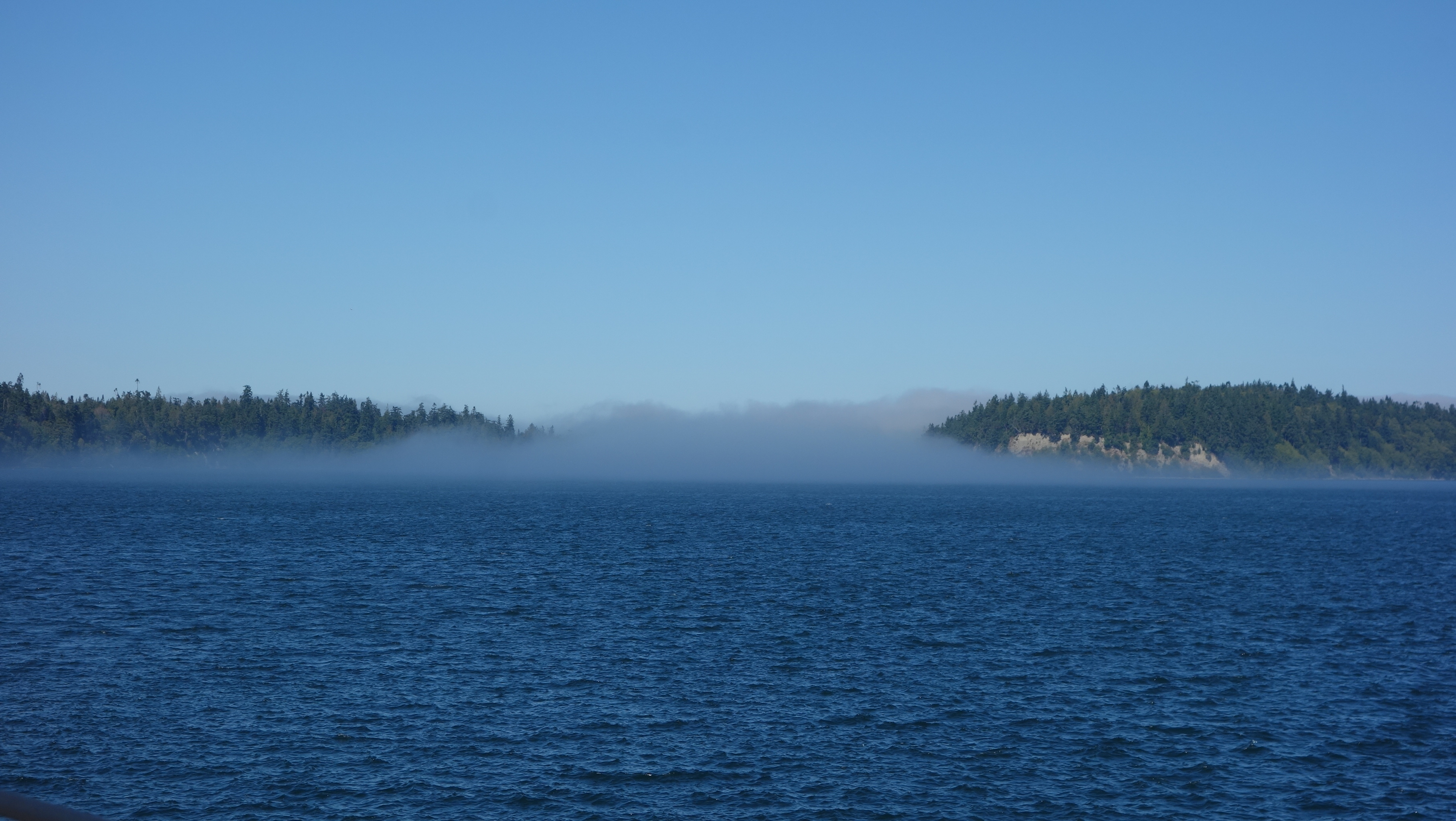
There was a fair amount of fog about this morning. Despite it being sunny in Seattle, there was fog all the way across Puget Sound and the ferry’s horn was frequently sounding to warn other craft that we were likely way bigger and they would be better off getting out of our way.

After a respectable crossing time, which I believe was accelerated due to the late departure, I was crossing into Kingston and once again, looking for a suitable place to buy a SIM card, in part, because I had no other real destination in mind. I wanted to go through Port Angeles but other than that, I really had no idea where I was going.

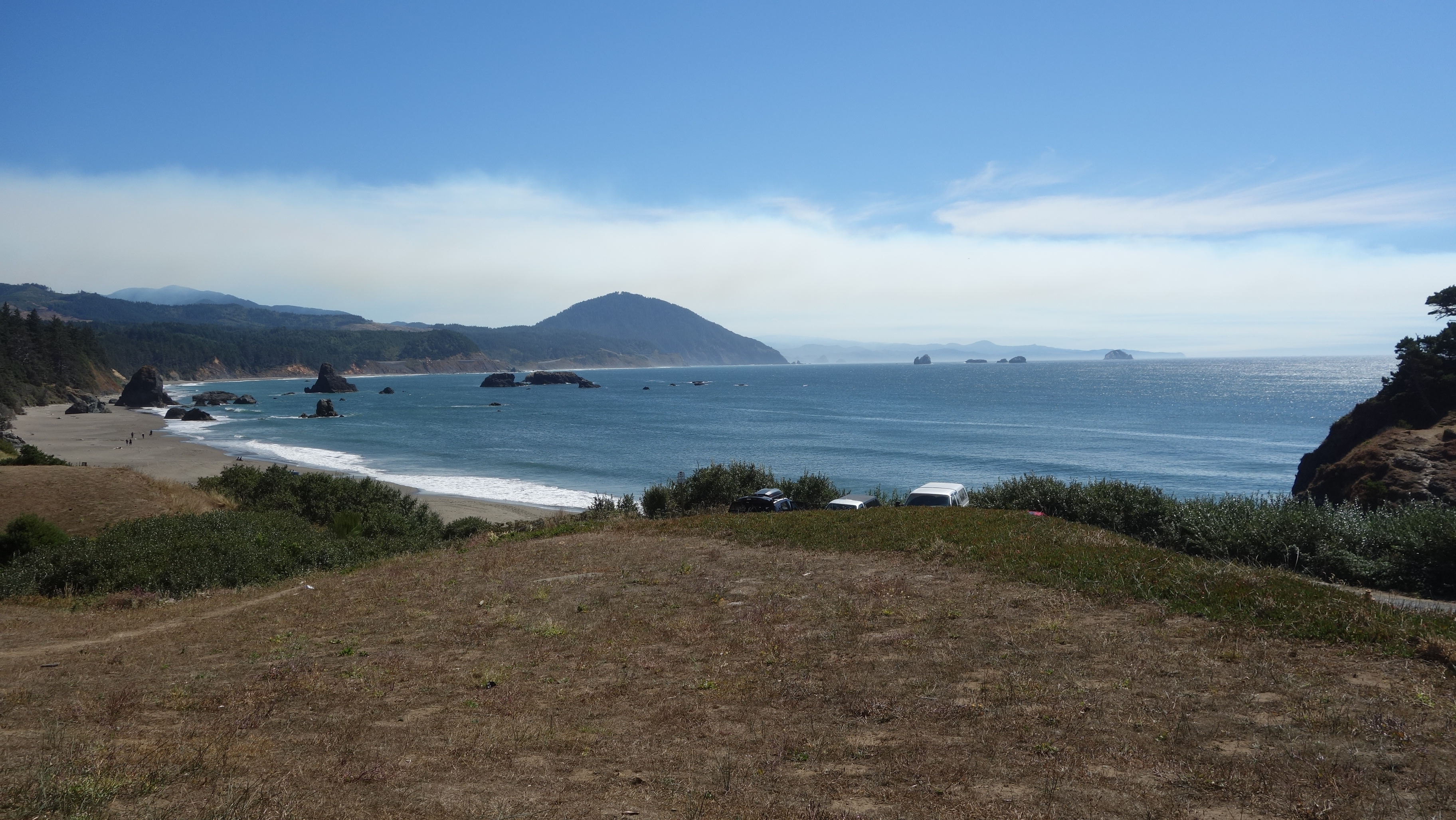
I was a little disappointed that there was not much beach front to see once I had been through Kingston and it was fairly straight forward riding until I got to Port Angeles, which, as it turns out, was big enough to have an AT&T store. So if you have been trying to phone me, don’t bother because I have a different phone number for the trip. However, I’ll save about $200 from the Bell Media thieves.

After Port Angeles, the road got a little more interesting and when I passed an intersection of Highway 101, upon which I was traveling and Highway 112, I stopped the bike and looked at Google Maps just to double check where 112 went and on a lark, turned the bike around and went down 112. Immediately, the road became much more interesting so I was promptly rewarded.

As the afternoon wore on, (I had exited Port Angeles about 2:30 pm or so) it was becoming increasingly clear that this was not going to be a big mileage day. In fact, by about 3:50 pm, the sun was getting lower and the thermometer was doing the same. Along 112, the road definitely hugs the coastline more, so I started thinking about just camping rough – on a beach or on a logging road, both of which were in plentiful supply. The only problem with that is that I would not have any water to cook some dinner and it would result in a short meal of protein bars and roasted almonds. Unless I found clams and cooked them in sea water. With a side of urchin roe.

Then I happened upon an intersection and I stopped the bike to look up where the respective roads went and what prospects I might have for camping. Turning left would take me back to the famed Highway 101, which will ultimately take me down the coast, and right would be to No Man’s Land BUT, also Sam’s Trailer Park. I bet THAT would be a good place to camp and it is probably on the water.

Well no, it does NOT look like a good place to camp. It looks like a homeless camp so I kept going a little further and into Clallam Bay. There is a sign that says Visitor Information and I figure it is about time to ask for some guidance. However, it is not clear where the Visitor Information is located so I go into the co-op store there and a kindly elderly (“older than me”) lady working in the store tells me that the county hasn’t bothered to move the visitor information sign and the store likes it that way because more people come inside.

I ask about camping and the store clerk is a wealth of information, pulls out a local map and points out where I could camp and even which beaches would be suitable. Then a shopper offers her suggestion of the place SHE is camping so I think that sounds pretty good. There are both giving me directions at the same time and I am not sure they are giving me the directions to the same place or different places so the shopper offers to lead me there. I carry her groceries to her car for her and first, she drives down the road in the opposite direction so that I can see a trail to a nice beach then she leads me to her campground, drives me through a “loop” in the “campground” and ends at the place where the owners of the campground are going to put a serious strain on my retirement finances. I’m thinking at this point the homeless camp is looking pretty enticing. My new found friend, Sally instructs me to visit Neah Point and be sure to hike down to the beach. She has a park pass and offers to lend it to me because it would otherwise cost me US $25. It’s 5:30 and she makes it sound so good I contemplate getting set up in my THIRTY FIVE DOLLAT CAMPSITE (see attached picture) and going out to the point before having dinner but I quickly realize that that would be foolhardy since it would likely be dark by the time I get back.

The Co-op store where Howie met Sally.
With my tent site established and dinner consumed, I wonder down to Sally’s camper. She and her husband Ernie camp here all summer then go down to Arizona and camp there all winter. He is a keen fisherman. She is not. They have other family there in attendance but it is not clear to me if they are all on the same schedule but they are a nice family. They even offered me clam chowder and to come back tomorrow night for the neighbourhood pot luck. I decline because I am a man on a mission.

As I finish this off tonight, the fishermen and women are all tucked in their beds. It is 9:20 pm and the people across the road have shut off their music. My next door neighbour, all of 5 feet away, tells me they will be up at 4:00 a.m. to head out to fish for Coho salmon tomorrow. I’ll try to sleep in.

BTW, it’s 11 degrees our here. Pictures will have to come Saturday morning since my computer was too tired to go on.


Camping location.


Elk in a farmer's field.


Puget Sound

 No riding today. 

My high school buddy and host Rob and I took a drive to his recreational property around Puget Sound to meet with the plumber working on his house cabin. 181 km, it was a 2 1/4 hour drive through gnarly 10 lane traffic.


We crossed the Tacoma Narrows Bridge, a double suspension bridge over Puget Sound. This is the site of the infamous Galloping Gertie, the name of the prior bridge that would bounce wildly in certain wind conditions. That bridge had a bad end months after it opened in 1940, which resulted in the construction of a new, then subsequent additional bridge. 

A short while later, we crossed the Hood Canal Floating Bridge, which is in fact a draw bridge designed to allow Trident nuclear powered submarines through Hood Canal for practice manoeuvres.  Rob's cabin is resident on Hood Canal and he described how, on occasion, submarines and sometimes war ships will be engaged in naval games just off his property and he has a front row seat to see the action.

Rob is the most easy going person you could hope to meet. He rarely worries about anything (a benefit of retirement) and doesn't feel at all bad about taking his time. We have been friends since grade 10, celebrating 49 years of friendship.


We were drinking then, too!

Back on the road tomorrow (Thursday).


Epilogue: more photos

  Week 1 Beach at Fort Stevens. Surfers at Fort Stevens. Nuts! Fort Stevens military lookout. Random small town buildings. Crab fishermen. S...